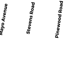
72 STEVENS RD
Owner Information
MCCARTHY, JOHN T. &
72 STEVENS RD
NEEDHAM, MA 02492


Property Details
72 STEVENS RD is classified as a Single Family Residential (Cl).
The primary structure on this property was built in 1948. There are 1456ft2 of built area within this property. There is 2590ft2 of residential/living space within this property. This property is listed as having 8 rooms.
72 STEVENS RD is valued at 965800. The land is valued at 522700 and the structures are valued at 443100.
This property is in Zone SRB. Confirm with local Zoning Board authorities to ensure there are no overlays or other easements on this property.
The most recent deed for 72 STEVENS RD is recorded at the local registrar in Book 14629, Page 550. 72 STEVENS RD was last sold on 2000-12-29 for 525000.
Assessment data from fiscal year 2022.
Flood Data
According to the FEMA National Flood Hazard Layer, this property does not appear to be in a flood zone. It may also be in an area not yet reviewed. Nonetheless, confirm this information prior to taking any action.
To view the flood hazards around this property, create a FEMA "Firmette" Map of the area around 72 STEVENS RD.
Broadband Internet Providers
| Provider | Type | Bandwidth (mbps) | |
|---|---|---|---|
| RCN | Cable | 500 | 20 |
| VSAT Systems, LLC. | Satellite | 2 | 1 |
| HughesNet | Satellite | 25 | 3 |
| GCI Communication Corp. | Satellite | 0 | 0 |
| RCN | Cable | 1000 | 20 |
| Comcast | Cable | 1000 | 35 |
| Verizon New England Inc. | Fiber | 940 | 880 |
| Viasat Inc | Satellite | 100 | 3 |
Broadband service provider data from December 2020.
Adjacent Properties
- 76 STEVENS RD
Single Family Residential owned by PINI, STEVEN & - 66 STEVENS RD
Single Family Residential owned by VAN AMSON, PAGE L. TR - 69 PINEWOOD RD
Single Family Residential owned by GILLIS, THOMAS & - 79 PINEWOOD RD
Single Family Residential owned by HUGHES, SANDRA CHEVRETTE - 73 PINEWOOD RD
Single Family Residential owned by STEVERMAN, JOHN C JR